A lowboy does not need a train to have a bad day at a rail crossing. It needs a crossing that sits higher than the road on either side. The tractor climbs the approach, the deck reaches the crest, and the middle of a long, low trailer settles onto the rails while the wheels at either end lose their grip. Nothing is broken. The truck simply cannot move, and it is parked across a railroad.
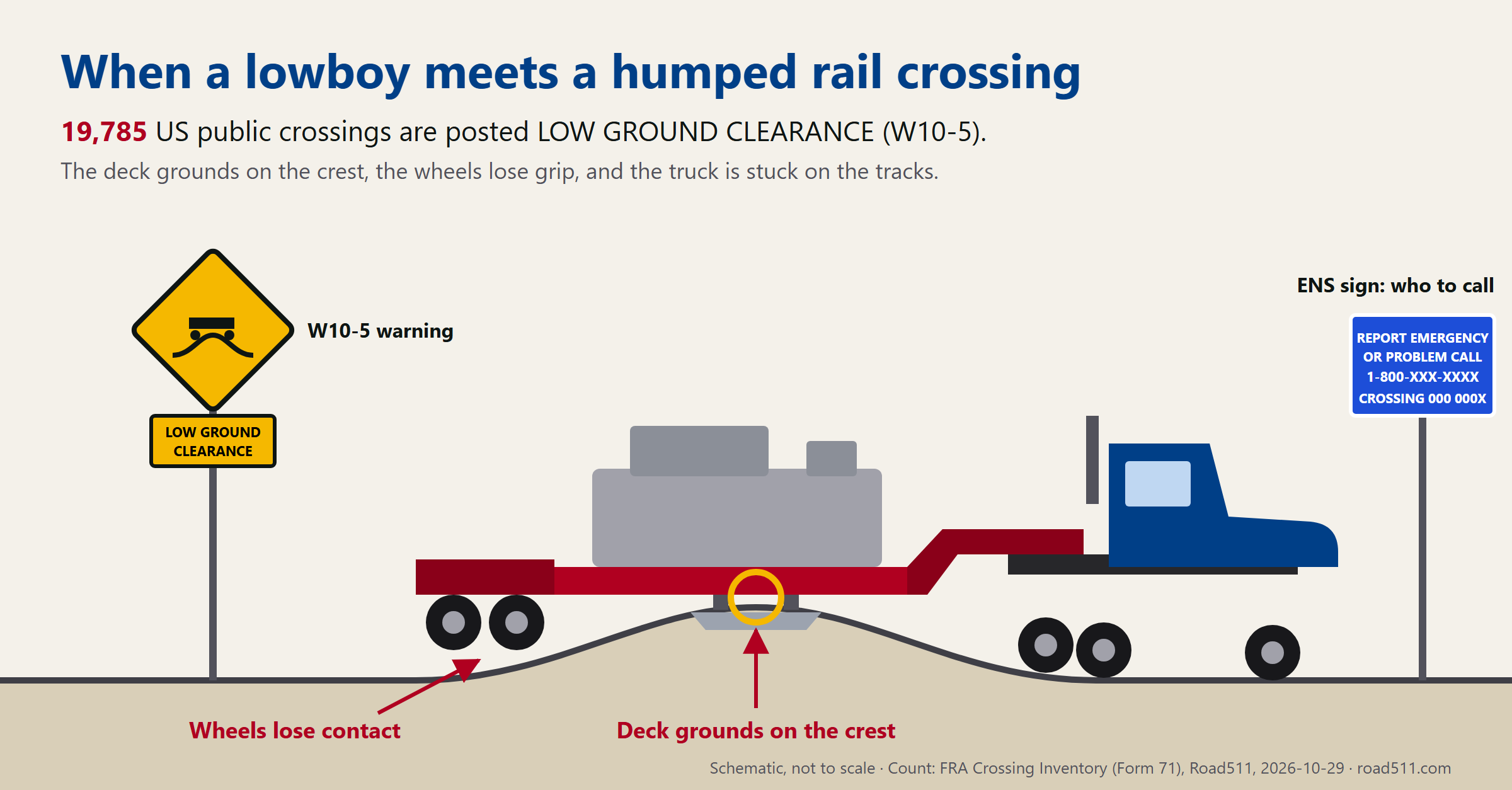
Two signs bracket that moment. Before it, the yellow W10-5 “Low Ground Clearance” warning, the one with a truck balanced on a hump. After it, the blue Emergency Notification System sign at the crossing, with a phone number and the crossing’s USDOT inventory number. The first decides whether you should be on this road with this trailer at all. The second decides how fast the railroad hears that you are stuck. Both are in the federal crossing inventory, and as of this week both are in Road511.
How Many Crossings Are Posted
Measured against our North American production database on 29 October 2026, across the 162,449 public crossings we carry:
| Reading | Count |
|---|---|
| Posted LOW GROUND CLEARANCE (W10-5) | 19,785 |
| … of those, at grade | 19,544 |
| … protected by passive signs only (crossbucks, stop sign, or nothing) | 9,531 — 48% |
| … on track with a timetable speed of 79 mph or more | 738 |
| … seeing 20 or more trains a day | 1,359 |
| Crossings with an emergency number in the inventory | 155,684 — 96% |
| Humped crossings with an emergency number | 19,703 of 19,785 |
That is one public crossing in eight. Most of them are quiet: the median humped crossing sees 4 trains a day on 25 mph track. But “most” is not the planning case. A few hundred sit on main lines where a train is fast and frequent, and on the fastest of them a stuck lowboy has very little time before the next train arrives.
The counts by state say as much about who fills in the inventory as about the terrain. Texas posts the most (2,092), Michigan has 1,959 — over a third of its public crossings — and Idaho marks 53%. Illinois, with 10,483 crossings, marks 7%. Treat a state’s share as a reporting habit before you treat it as geography, and treat an unmarked crossing as unknown rather than flat.
The Blue Sign
Since 2017 every railroad has had to post an ENS sign at its crossings (49 CFR Part 234, Subpart E). The rule is specific: white on blue, retroreflective, at least 12 by 9 inches, a phone number, a line such as “Report emergency or problem to …”, and the crossing’s USDOT number. When someone calls to report a vehicle on the tracks, the railroad must promptly contact every train authorised through that crossing, then the police, then get the obstruction removed.
That chain starts with a phone call, and the call depends on two things the driver may not have in the moment: the right number, and the crossing ID. 911 works too, but a dispatcher then has to find the railroad. Calling the number on the sign goes straight to the railroad that controls the trains.
In the inventory, 1,478 humped crossings are recorded with the ENS sign not displayed. The regulation says it should be. Either the record is stale or the sign is gone, and from the cab the difference does not matter: the number is not on a post in front of you. It is in the data.
On the Route
Crossings ride the same call to POST /api/v1/routing/route that returns the truck-aware route and its warnings:
- Any truck: a humped crossing on the corridor comes back as “Humped rail crossing — low ground clearance”, with the railroad’s emergency number in the text when the inventory has one.
- Placarded hazmat: every public at-grade crossing is still a
criticalstop under 49 CFR 392.10. The hump and the ENS number are appended to the same warning. - Crossings posted “Exempt”: 686 of them. Under 392.10(b)(5) no hazmat stop is required where that sign is posted, so the warning drops to
infoand says why.
A planner sees the humped crossings on a lane before the permit is filed, and the driver gets the phone number with each one, ready before the truck is stuck rather than looked up after.
Query It Directly
GET /api/v1/features?type=rail_crossings&jurisdiction=MI&limit=5Each crossing carries low_ground_clearance_sign and its sign count, ens_sign, emergency_phone, exempt_sign, the share of trucks in road traffic (percent_trucks), the road’s speed limit and lane count, the crossing angle, and whether it is lit — alongside the railroad, the USDOT crossing number, the warning device, train counts and track speed that were already there.
What This Data Is Not
- It is a sign, not a survey. W10-5 says somebody judged the crossing a hump risk and posted a warning. It does not give the crest height, the approach grade or the clearance your trailer needs, and a crossing without the sign can still catch a low enough deck.
- It is an inventory, not a sensor. Railroads and states file it and update it on their schedule. A sign recorded as posted may be missing, and the reverse.
- Absent is unknown. About 26% of the crossings we carry have no matching sign record at all. Those are unknowns, not “no sign”.
- It does not know where the trains are. Train counts and speeds are inventory figures. Nothing here is a live train position.
Provenance
Both the crossing geometry and the sign fields come from the Federal Railroad Administration: the national crossing inventory layer we already read, now joined to the full Crossing Inventory (Form 71) by USDOT crossing number. Both are in the public domain. Every figure above is a count you can reproduce against the live API.
Try It
- The hazmat stop at at-grade crossings — the 392.10 side of the same data.
- API docs — features, routing, and the GeoJSON variants in one reference.
- Free API key — 14-day trial, no credit card.
Find the humps before the permit, not on the crossing
Truck-aware routing with humped-crossing and hazmat-stop warnings, bridge clearances, weight restrictions and live work zones — one call.
Get an API key Read the docs